
Developing or subdividing property? Confirming a boundary? Planning construction or managing rural land and infrastructure?
Treasco Surveyors provides surveying, planning and spatial information services for projects of different sizes and stages. We work with property owners, developers, councils, consultants, energy companies and construction professionals to understand the land, identify constraints and provide reliable information for the decisions ahead.
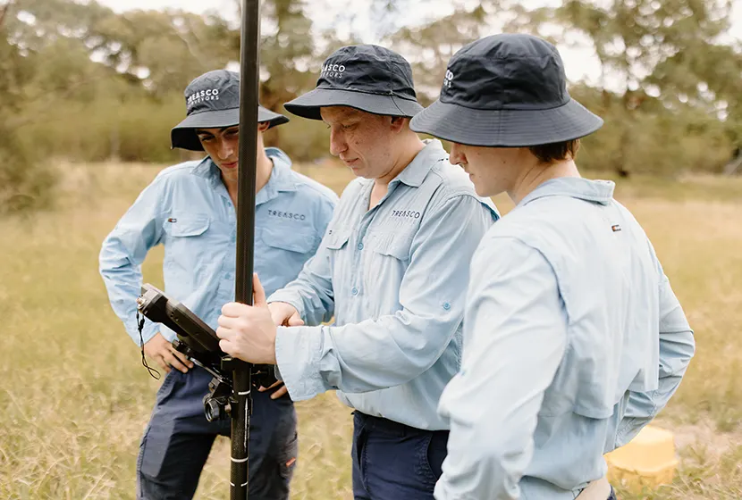
Every project starts with a different question.
You may need to understand whether land can be subdivided, establish where a property boundary lies, capture the existing conditions of a building or survey an infrastructure corridor across difficult terrain.
Treasco Surveyors takes the time to understand what you are trying to achieve, how the survey information will be used and which other professionals are involved. We then recommend a scope and survey method appropriate to your site, project stage and intended outcome.
Our services combine professional surveying knowledge with technologies including GPS, aerial drones, photogrammetry, LiDAR and 3D laser scanning.

Capture a detailed digital record of a building, structure or site.
3D laser scanning collects extensive spatial information about visible surfaces and converts it into a three-dimensional point cloud. This can support existing-condition documentation, architectural and engineering design, construction verification, heritage projects and complex building-services coordination.
It is particularly useful for irregular structures and spaces that would be difficult or time-consuming to measure manually.

Capture large, remote or difficult-to-access sites efficiently from above.
Treasco Surveyors uses drone photogrammetry and aerial LiDAR where appropriate to collect high-resolution imagery and three-dimensional spatial information. Aerial surveying can provide valuable context across rural properties, development sites, construction projects, infrastructure corridors and environmental areas.
Drone data may also be combined with ground-based surveying to establish control, verify important features or capture details that cannot be seen clearly from the air.

Surveying support from early feasibility through design, approval, construction and completion.
Property development involves interconnected questions about boundaries, terrain, access, drainage, easements, services and planning requirements. Identifying these matters early gives developers and consultants a stronger foundation for design and decision-making.
Treasco Surveyors works with developers, architects, engineers, planners, solicitors, builders and councils to coordinate the survey requirements at each stage.

Practical surveying services for farms, rural holdings and large land areas.
Rural properties can involve extensive boundaries, historical survey information, difficult access and varied terrain. We use appropriate combinations of conventional surveying, GPS, drone technology and LiDAR to collect reliable information efficiently.
Our rural surveying services support property ownership, fencing, access, subdivision, development, infrastructure and land-management decisions.

Understand the potential of your land and the process required to create new lots.
Subdivision feasibility depends on more than property area. Planning controls, access, services, drainage, easements, terrain, environmental matters and council requirements can all influence the outcome.
Treasco Surveyors assists with residential, rural and development subdivisions from initial investigation and concept planning through cadastral survey, certification and registration.

Reliable spatial information for infrastructure design, delivery and asset records.
Treasco Surveyors works with energy companies, network providers, engineers, principal contractors and construction professionals on power lines, communication towers, access tracks and related civil infrastructure.
We can support projects from route investigation and existing-condition surveys through survey control, construction set-out, progress measurement and final as-built documentation.
Our core service areas are supported by a broad range of specialised survey, planning and documentation services.
The service required will depend on your objective, property and project stage. If you are unsure which survey applies, begin by explaining the decision you need to make rather than trying to select a technical survey type.
You do not need to know the technical name of the survey before contacting us. Start with the question you need answered.
| Your objective | A likely starting point |
|---|---|
| Confirm a property boundary | Boundary or cadastral survey |
| Design a new building or extension | Detail and level survey |
| Investigate subdivision potential | Title review and subdivision feasibility |
| Capture a complex existing building | 3D laser scanning |
| Survey a large or remote site | Aerial drone or LiDAR survey |
| Position proposed construction | Construction set-out |
| Record completed works | Work as executed survey |
| Calculate stockpile or earthwork volumes | Volume or surface survey |
| Create an access or utility right | Easement survey and plan |
| Survey rural land or infrastructure | Rural, corridor or aerial survey |
Some projects require more than one survey method. We can recommend a coordinated scope so that the information collected at one stage remains useful at the next.
Confirm boundaries, understand existing site conditions and obtain the information needed before buying, renovating, extending or building.
Define boundaries, plan fencing, investigate subdivision, establish easements and capture terrain or infrastructure across extensive landholdings.
Coordinate survey requirements from feasibility and concept design through approvals, construction and registration.
Receive reliable existing-condition, boundary and topographic information prepared around the design or assessment task.
Set out approved works, maintain project control and document completed construction.
Obtain survey plans and spatial information for assessment, infrastructure, land management and asset-recording purposes.
Support biodiversity, conservation and land-management projects with appropriate boundary and spatial information.
Survey power lines, communication sites, utility corridors, access tracks and associated civil works.
We begin with the reason for the survey. Knowing whether the information is for a purchase, design, approval, legal matter or construction task helps us define the right scope.
Where relevant, we review title documents, existing survey plans, design files, approvals and other project information.
We consider the required accuracy, site conditions, access, terrain, vegetation, project area and final deliverables before recommending a survey approach.
Our team collects the required measurements using the technology and procedures appropriate to the project.
We assess the collected data, undertake appropriate checks and prepare the agreed plans, models or digital files.
We explain the outcome and can coordinate with your architect, engineer, planner, solicitor, builder, council or other project professionals where required.
Good surveying is not simply about collecting measurements. It is about understanding which information matters, how accurate it needs to be and what the client or project team must do with it next.
Treasco Surveyors combines professional knowledge, practical advice and modern survey technology to deliver information suited to its intended purpose. We ask the right questions, tailor the scope and communicate clearly throughout the work.
Our focus is straightforward:
Whether you are developing property, confirming a boundary, planning a subdivision or delivering infrastructure, early survey advice can reduce uncertainty and help your project move forward.
Call (02) 6881 8199 or email projects@treascosurveyors.com.au to discuss your project.